Appia roadSegment 20
From MIRABELLA PASS (Aeclanum) to SANTA VENERE bridge (Pons Aufidi)
The route we now follow runs along the watershed of the Ufita and Ofanto rivers and is the one proposed by Prof. Lorenzo Quilici (q11) in his text “Via Appia – dalla pianura pontina a Brindisi”, although other routes are presented by various scholars.
Some have proposed that the Appia road followed the Ufita River from the Mirabella Pass and, only near its source, faced a steep slope (360 m) to arrive at Piano La Toppa (988 m).
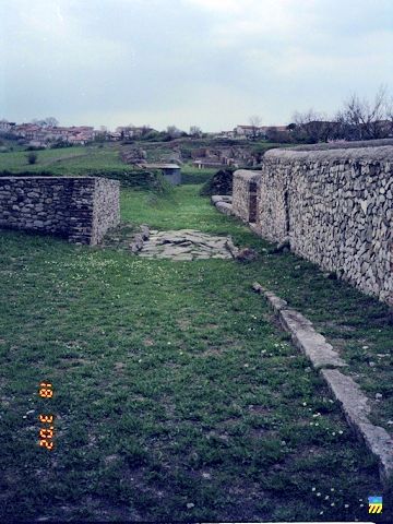
At the Mirabella Pass (statio Aeclanum (**), excavations reveal a more complex locality than a simple Statio (*).
From the Mirabella Pass we follow the SS 303 – Strada Statale 303 -, which tortuously overcomes a steep gradient (350 m) and then remains at high altitude for many kilometres. It is assumed that the Appia road also overcame this gradient with a steep incline, but there is no trace of where the ancient road actually passed, nor any historical finds.
But in the village of Frigento (**), the remains of a Roman cistern and a villa are preserved.
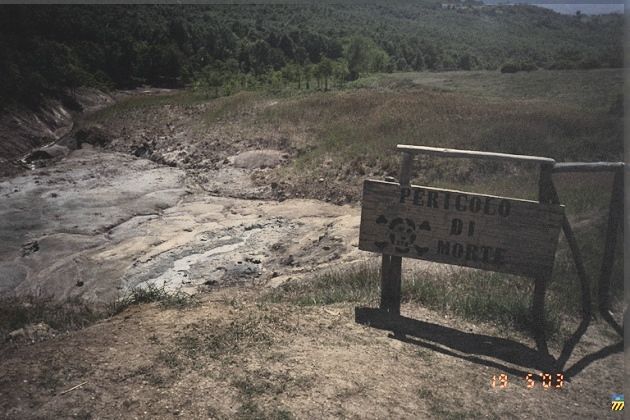
Before reaching the locality Piano La Toppa , probably the ancient statio Subromula, we find the crossroads for the locality La Mefite (**).
In this locality, a volcanic spring has created a small lake that exhales poisonous gases and is mentioned in classical texts as ‘the gateway to the Underworld (Pliny)’.
The temple of the goddess Mephitis was located there.
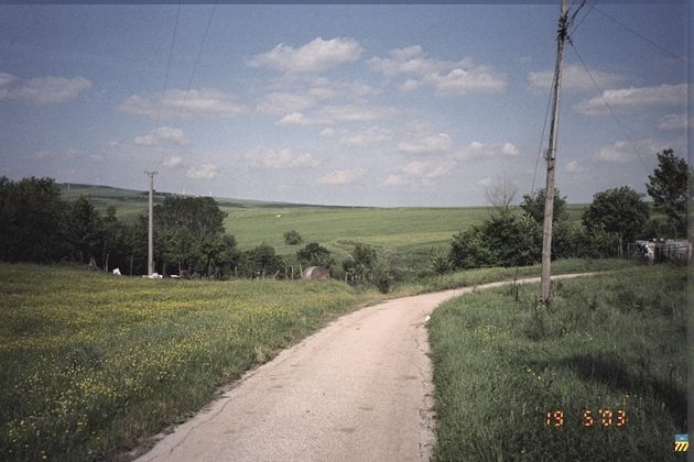
From Piano La Toppa to Lacedonia, probable statio Aquilonia, one could recognise the Appia road in the straight stretch of a sheep-track that accompanies the SS 303, cutting all modern curves.
No historical finds are to be found on this segment.
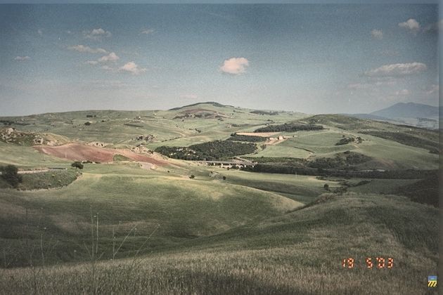
On the other hand, the route offers grandiose views of Irpinia.
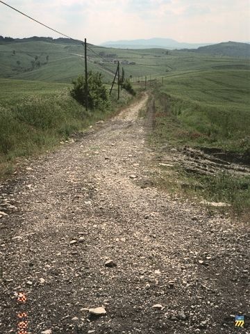
Beyond Lacedonia we can clearly distinguish a straight sheep-track that crosses the present road several times and may belong to the route of the Appia road.
8 km after Lacedonia, the present road, which we have followed from the Mirabella Pass, heads towards Candela, while the Appia road turns east and, following the sheep-track, descends the steep ridge to reach the bridge of Santa Venere over the Ofanto river, where the statio Pons Aufidi was probably located.
—————-
| (*) See | Statio |
in glossary.
| (**) See : | Aeclanum, |
| Frigento (1 km), | |
| La Mefite (2 km) |
are worth a visit.